![]()
CLIENT: Midpeninsula Regional Open Space District
 The Midpeninsula Regional Open Space District contains over 50,000 acres
of land throughout the east and west slopes of the Santa Cruz Mountains
in 25 preserves. The District was becoming increasingly aware that invasive
plants and animals were one of the number one impacts to the biological
health of lands under their stewardship. Their current invasive plant data
was old and incomplete.
The Midpeninsula Regional Open Space District contains over 50,000 acres
of land throughout the east and west slopes of the Santa Cruz Mountains
in 25 preserves. The District was becoming increasingly aware that invasive
plants and animals were one of the number one impacts to the biological
health of lands under their stewardship. Their current invasive plant data
was old and incomplete.
Mapping and analysis are the first steps to developing control and prevention strategies for invasive plants.
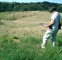
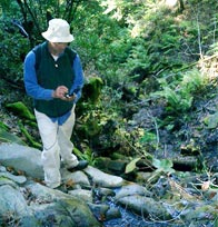
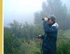
In 2003, Shelterbelt was hired to help the District prepare an invasive plant management plan. The plan sought to better define invasive plants on District lands, identify occurrences and develop ranking criteria and strategies for their control. The heart of the plan was to analyze existing weed distribution data and identify areas to survey with updated methods. Shelterbelt staff surveyed 10 priority preserves over a 7 month period with GPS units and laptop computers. Data was compiled for each preserve and submitted to the District for use in a compatible format for their GIS. A final report summarized the findings for the entire District, recommended control and prevention strategies, evaluated the District’s current control programs and commented on detailed species-specific invasive plant control recipes.
Headquarters: 22400 Skyline Boulevard #18, La Honda, CA 94020 Tel: 608.208.8074
East Bay: 510.841.0911
Email: [email protected]